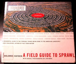
I picked up this book recently from the library to thumb through. It is a coffee table lark on sprawl, told primarily through the use of very effective aerial photos.
I had two major takeaways:
The first is how much things have changed in terms of the perception of the suburbs, and sprawl in general, since it was published just a few years ago in 2004. The advent of the economic crisis and the subsequent housing slump, which has been felt most heavily in the suburbs, has been a game changer. Add to that the shifting demographics of age and race and the tottering state of many retail strip centers and malls in our outlying metro areas, and you have a mix of conditions that makes it difficult to predict the future of many of these communities.
The second takeaway is to marvel at how very creative we are, as a people. I mean, it requires a tremendous capacity for imagination (and a complete lack of sense) to dream up this many ways to screw up land use so spectacularly!
Recently, Big Picture featured a great aerial photo essay on sprawl development in SW Florida that is similar to the photos found in this book. In this case though, it looks like Google Earth was employed to capture the images, instead of a photographer in an airplane!
{ 0 comments }
